Area of benefit
In order to qualify for a charitable grant, applicants must reside within the original boundaries of Wolverton, Bradwell and Stantonbury Parishes as defined by the 1881 map in possession of The Wolverton Science Trust and within the boundaries as outlined below.
Should any new area of residential property be built within the boundaries outlined above they will be added to the list.
WOLVERTON
Wolverton, Old Wolverton, Wolverton Mill, (including East and South), Stratford Park, Greenleys, Kiln Farm, part of Two Mile Ash (that which lies within the original parish of Wolverton), Stacey Bushes, Hodge Lea, Blue Bridge, Bancroft and Stonebridge.
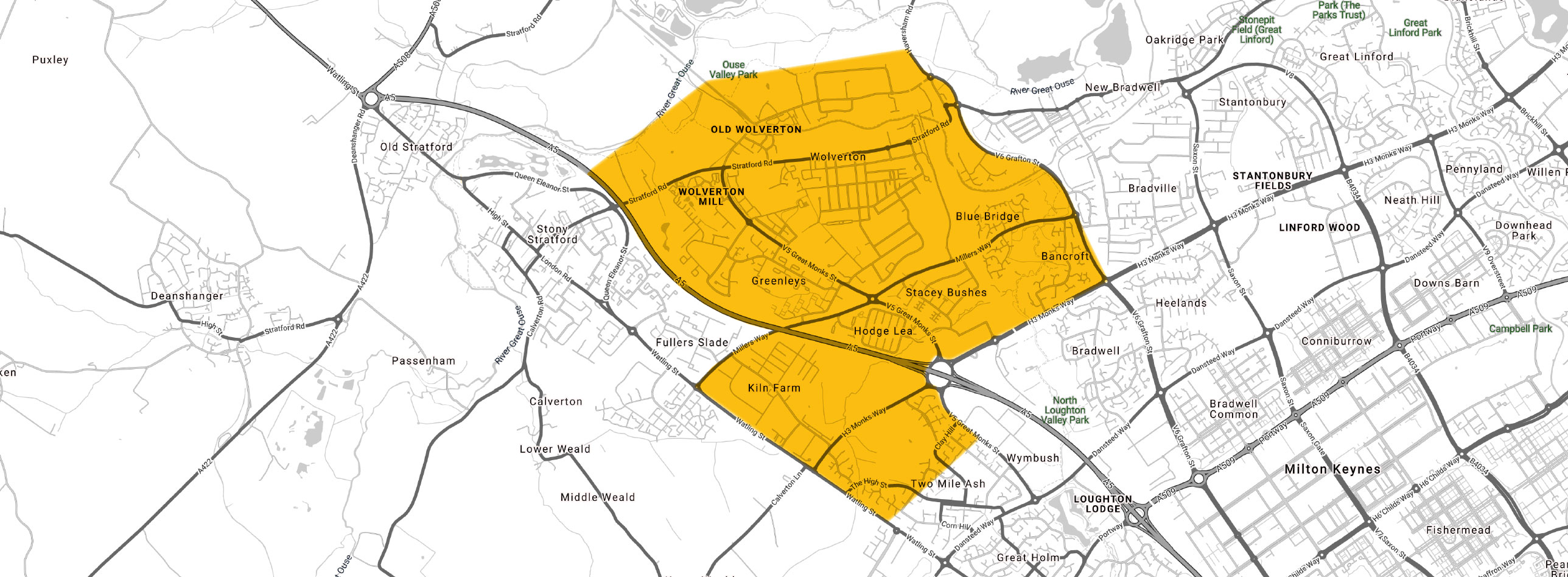
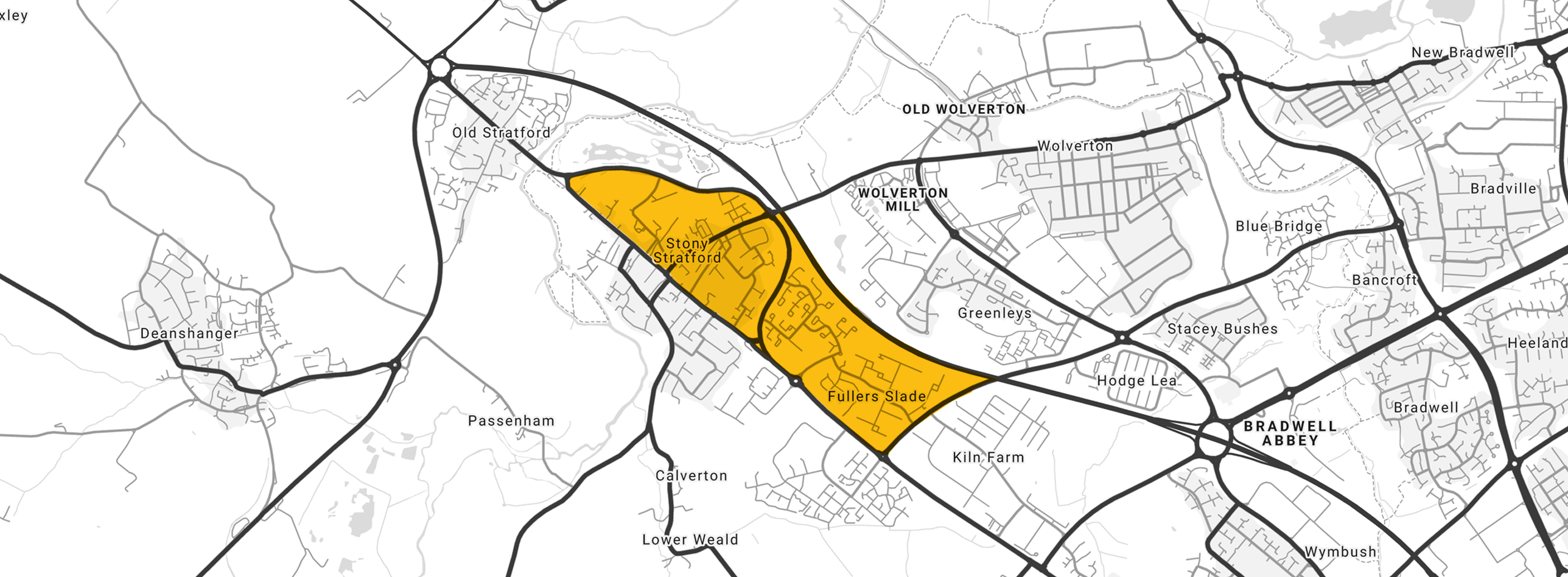
STONY STRATFORD
Stony Stratford, Fullers Slade and Galley Hill.
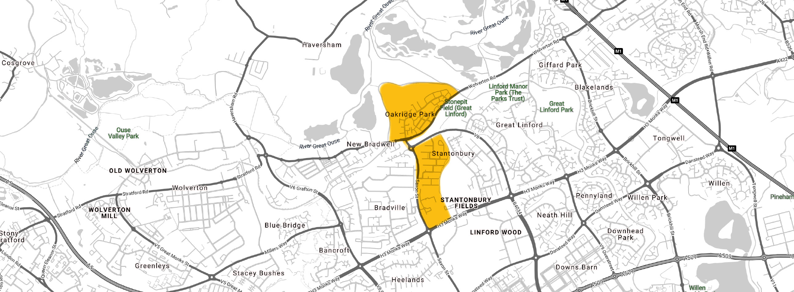
STANTONBURY
Oakridge Park, Stantonbury (only that west of the redway that runs North- South down it) and Stantonbury Campus.
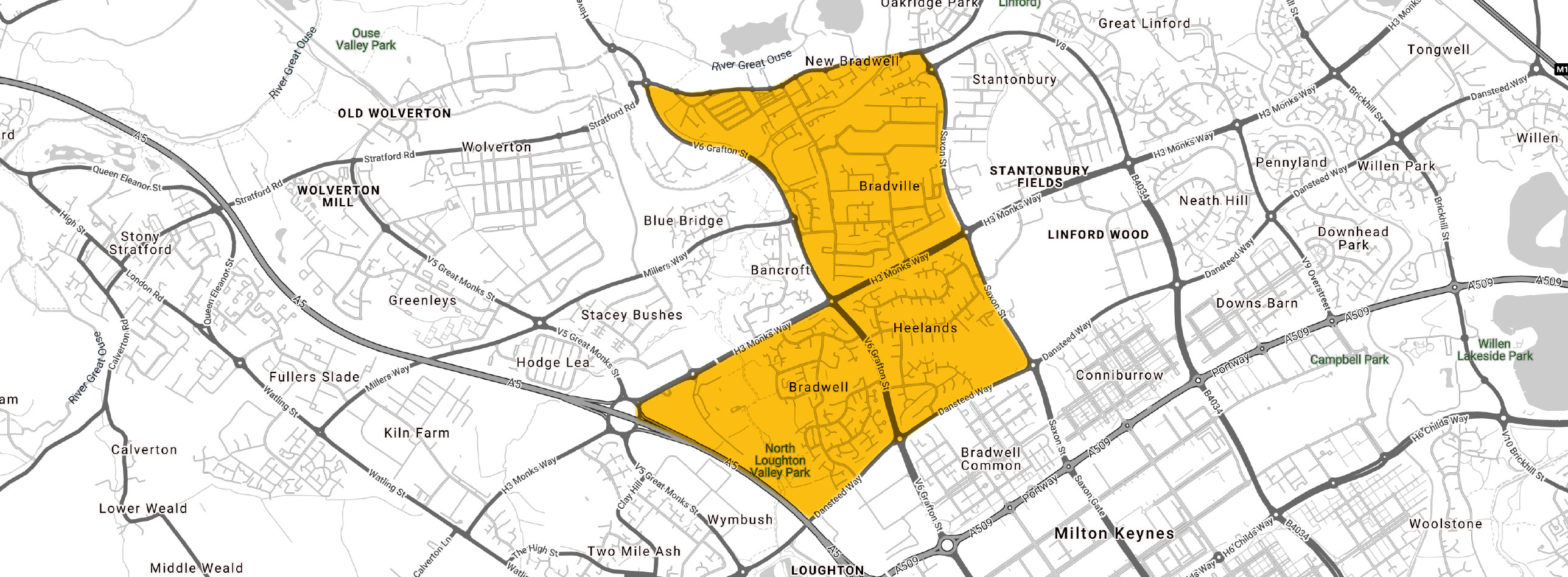
BRADWELL
New Bradwell, Bradwell (which includes Old Bradwell), Bradville and Heelands (only that north of redway that is in original Stantonbury Parish).
not in the scheme
BRADWELL COMMON
HEELANDS
(South of redway that does not lie within original Parish of Stantonbury)
CONNIBURROW
NEATH HILL
FAIRFIELDS
ROOKSLEY
GREAT LINFORD
STANTONBURY FIELDS
HAVERSHAM
WHITEHOUSE
plus others not named but even further removed from Area of Benefit.